


Best to hold phone horizontally!
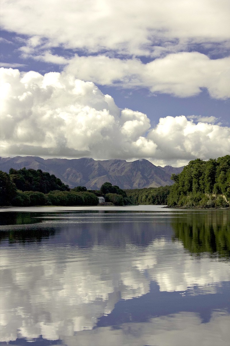
Te Waka a Maui
Te Waka a Maui - "Maui's Canoe" - the South Island of New Zealand.
This is the middle of our South Island journey in 2008. From Milford Sound on the West Coast, to Invercargill, right to the southern end of the South Island, then back up to central Otago and a week at Wanaka, where first of all it snowed (only on the ranges) then was blazing hot for the week.
To see the North Island part of our journey, see Te Ika a Maui.
All the way South
Not truly all the way, as we didn't have time to travel to Stuart Island. But as far south as you can get on the "Mainland" - which is what South Islanders like to call the South Island when talking to North Islanders - because the South Island is in fact larger than the North Island, despite having the smaller population.
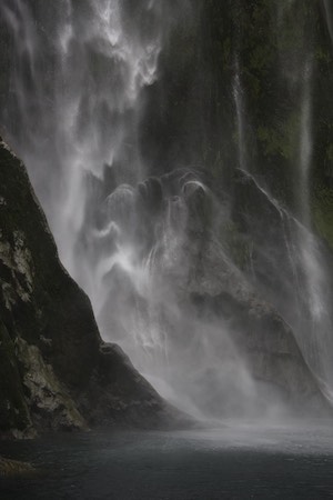
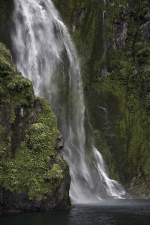
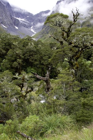
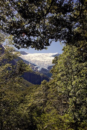
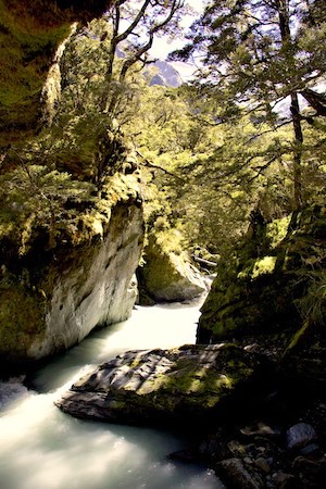
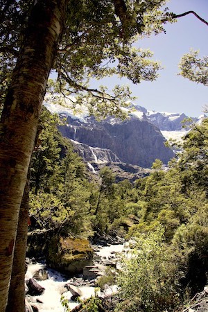
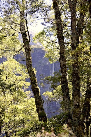
Milford Sound
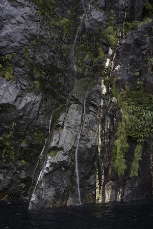
Milford Sound - back on the West Coast although not acessible from the rest of the West Coast - is one of New Zealand's premier tourist destinations. And it is very dramatic and beautiful. But in a location where rainfall is plentiful - 6.8 metres per year on average - we were unlucky that it didn't rain much. It is a place of waterfalls - many, many waterfalls - but these waterfalls have very small catchments and depend upon rainfall to function. We arrived in what is locally termed a drought (two weeks without rain) and possibly had the worst possible outcome - low clouds, poor light, and threatening rain - but few waterfalls. But still it was beautiful, and we have to return to see it in its true glory.
The boat cruise down the sound to the open sea and back, the underwater observatory they took us to on the way back, and the trip back to our campground made a very full day
-
Milford Tracery
-
Milford Getting the eye
-
Milford Still wet
-

Milford Perched
-
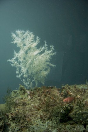
Milford Observed
-
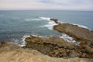
Milford Rocky
-
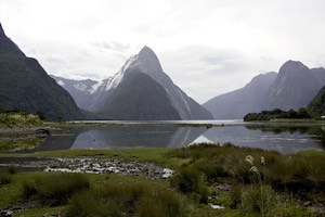
Milford Mitre Peak


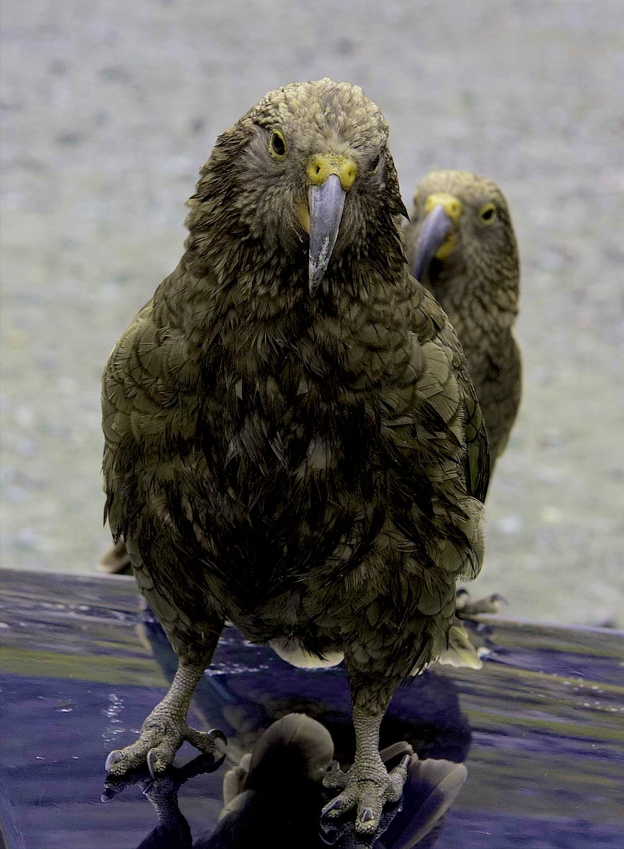
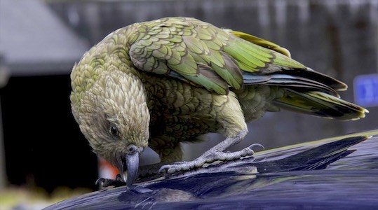
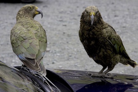
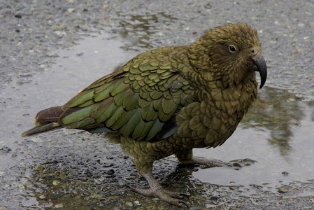
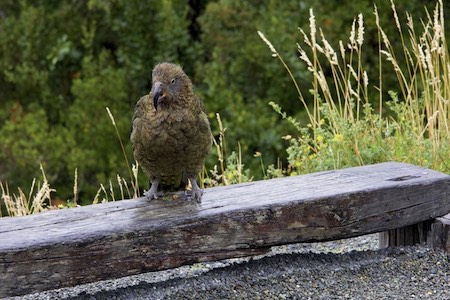
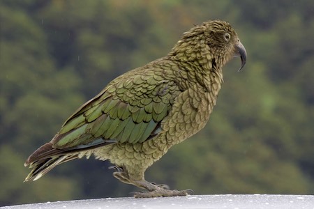
Keas
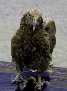
Keas (native parrots) were very much in evidence on the way there. Attractive, very mischievous, and very destructive - we had to watch the little monsters very carefully.
-
Keas Look at me
-
Keas Attack
-

Keas Watchful
-
Keas Little monsters
-
Keas Contemplating
-
Keas Resting
-
Keas Posing


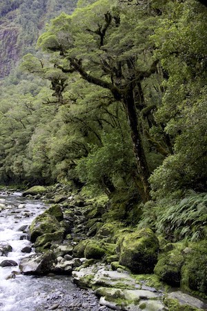
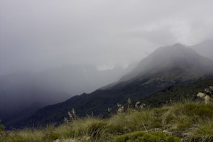
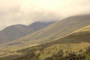
Along the Milford Highway
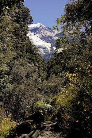
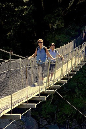
The wild and rugged scenery on the Milford Sound highway that provides the only road access to Milford looked very Tolkienesque under lowering clouds. Travelling back the day after cruising the sound we hiked up part of the Routeburn Track, to Key Summit, with our eyes on the rainstorms all the way. Ah, exercise at last! Being a tourist is hard work, but it's still hard to get enough exercise.
-
Gertrude Beech trees
-
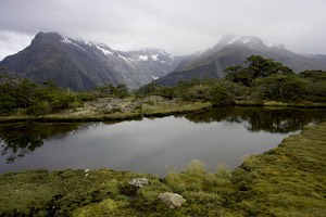
Gertrude Tarn
-
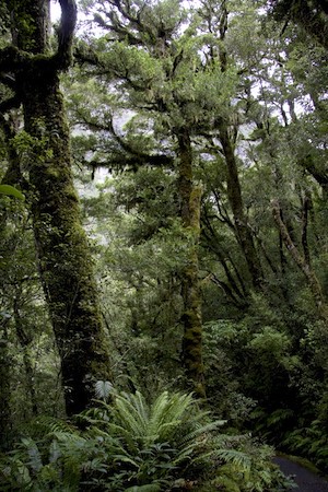
Gertrude Beech trees
-

Gertrude tiny waterfall
-
Gertrude View from the lookout
-

Gertrude Gertrude Valley
-
Gertrude Rainstorm approaching
-
Gertrude Dwarf gentians


Completing the journey south
Then on south to Te Anau, the Rakatu Wetlands, Clifden Bridge (that looks just like an also-abandoned bridge in the Fraser Canyon (in BC) - proving that we were all in the same British Empire) and finally, Invercargill.
-
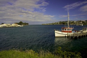
Invercargill Riverton Harbour
-
Invercargill Pearl Harbour
-
Invercargill Roadside decoration
-
Invercargill Lampshade for the lads. Although the Invercargill lads aren't b
-
Invercargill Te Waewae Bay
-

Invercargill Rakatu Wetlands
-
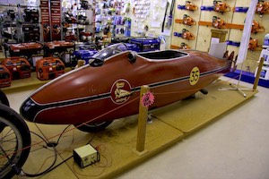
Invercargill The streamlining for Burt's bike. (Look at the movie - it's a fu
-
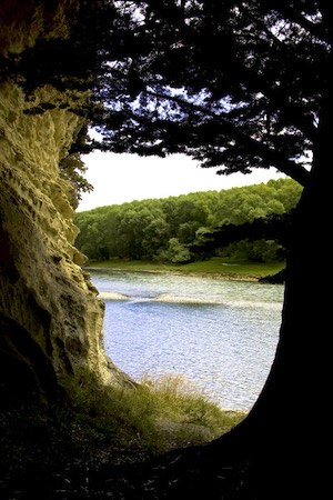
Invercargill Waiau River
-
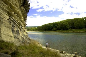
Invercargill Waiau River
-
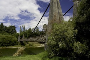
Invercargill Clifden Bridge
-
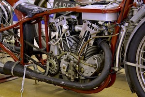
Invercargill Burt Monroe's modified 1920 Indian Scout, used to set a 200 mph
-
Invercargill Looking north in Te Waewae Bay near Waihoaka


Turnaround
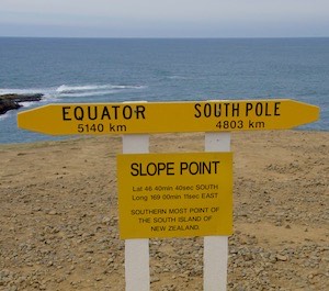
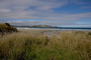
The true south end of the South Island is not at Invercargill, or Bluff (the nearby seaport for Invercargill) but further east, at Slope Point. We camped near there, in Curio Bay, where penguins come ashore at night, and tourists swim with dolphins by day.
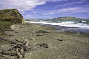
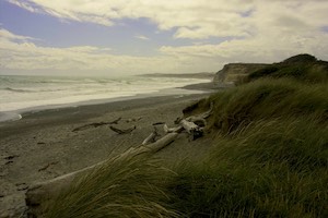
The Catlins
-
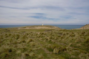
Catlins Slope Point navigation light
-
Catlins Homeward bound
-
Catlins Wind wracked
-
Catlins Closer to the Pole
-

Catlins Cathedral Cave
-
Catlins And another way out
-
Catlins Shell hunt
-
Catlins There it is
-

Catlins Tide in knots
-
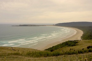
Catlins Tautuku beach
-
Catlins Porpoise Bay
-

Catlins Hunting dinner
-
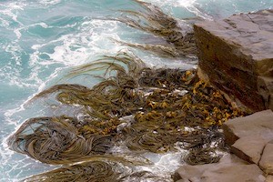
Catlins More knots


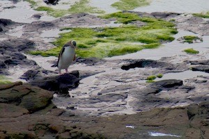
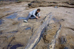
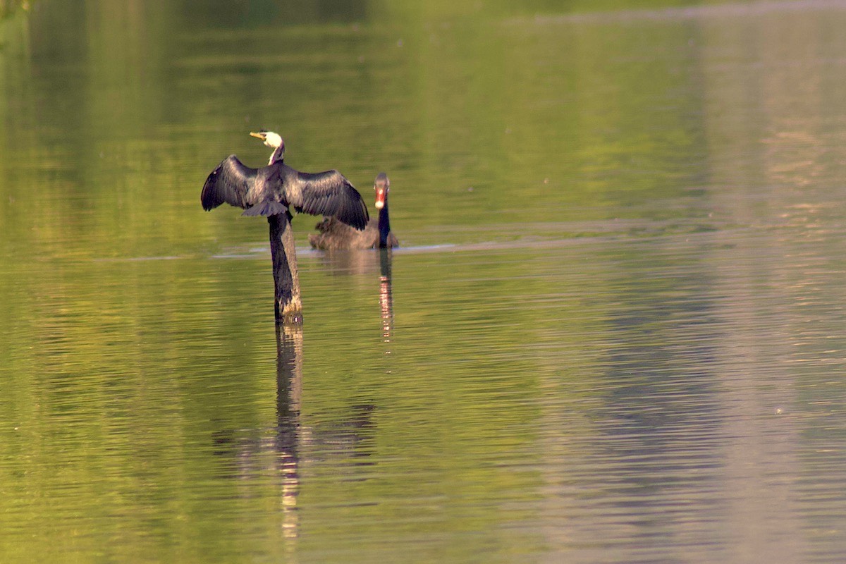
Curio Bay, in the Catlins, is indeed a curious place. As far south as you can go without getting your feet wet, it has on one side a rocky shore where many of the rocks have petrified trees embedded in them, and the same shore and wooded bank is a yellow-eyed penguin colony. Around the point is the long sandy beach fronting Porpoise Bay, where Hector's Dolphins breed. They are small - one of the smallest dolphins - and friendly. They happily swam with a Dutch tourist we met who had braved the rather cold water.
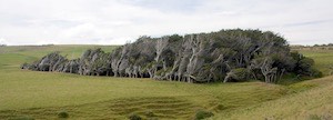
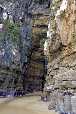
Slope point is the true southern tip of the South Island. It must be windy there, as the few trees are bent and misshapen by wind that was happily absent when we visited on a calm and mild Summer's day. I don't fancy visiting there in Winter. Further east, the Cathedral Caves are large enough to deserve the name, and the tide was kind enough to to be out so that we could visit.
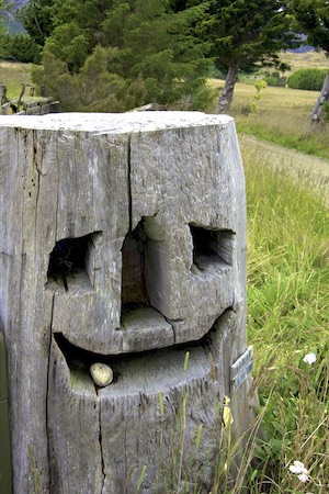
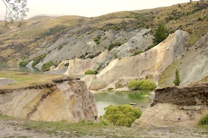
The Goldfields
-

Goldfields Halucination
-
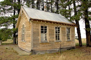
Goldfields Abandoned schoolhouse
-
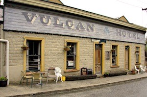
Goldfields Vulcan Pub
-

Goldfields Dead Horse Pinch
-
Goldfields Former railway station
-
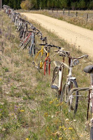
Goldfields We made a fence out of all these bikes
-
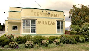
Goldfields Milk Bar
-
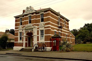
Goldfields Solid PO
-
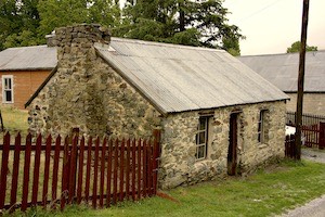
Goldfields Durable
-
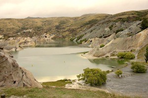
Goldfields Swimming hole
-

Goldfields Sharon the postmistress
-

Goldfields Gold-panner
-
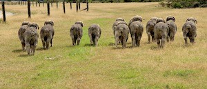
Goldfields Merino bums
-
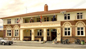
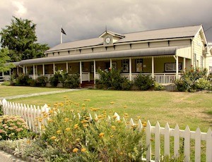
Goldfields Ranfurly Hotel
-
Goldfields Snow
-

Goldfields Eclectic
-
Goldfields Old loyalties
-
Goldfields Dead Horse Pinch
-
Goldfields Colourful swimming hole
-

Goldfields Saint Bathans PO


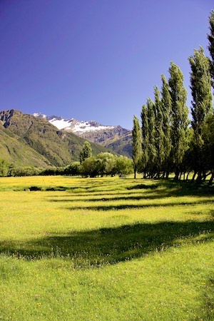
Rather rushed through Dunedin, but did spend some time at their magnificent Art Gallery. Then headed back into the Central Otago hills via the curiously named "Dead Horse Pinch" and the somewhat Art Deco'd town of Ranfurly. We did not know it at the time but it seems that nearby was one of the many "Lord of the Rings" film locations and was used as the "plains of Rohan."
Spent a very wet and chilly night at Naseby - a gold rush town - where the roof of the campground kitchen leaked copiously. New Zealand campgrounds (other than DOC sites) are commercial and have very good facilities, nearly always including a communal kitchen with multiple cook stoves and washing up facilities. Great social gathering spots and very convenient - consequently we did not often use the camper van kitchen.
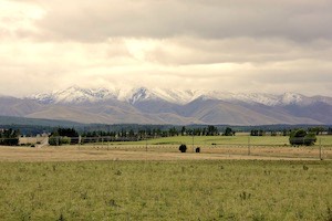
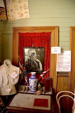
Next morning the ranges (meaning mountains) were covered in fresh snow - something of a surprise in mid-Summer. We found an attractive old one-room schoolhouse near Wedderburn - abandoned now with relics of its last use still pinned to the walls - and lunched in St. Bathans, another old mining town. The Vulcan pub has its bar so close to the front door that you can practically reach your pint from the street. And at the Post Office, Sharon the Postmistress was larger than life and full of stories. She keeps a picture of the Queen on the wall - Queen Victoria!
We had to rush on to Wanaka to pick up the key to the house we were renting for the week. But on the way out of St. Bathans we did stop to admire the pink elephant letter box and the "bike fence."
A Week in Wanaka
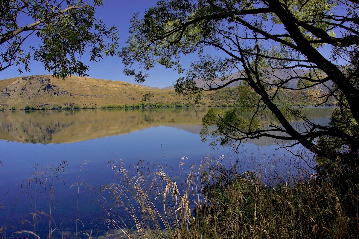
Our cousins joined us in Wanaka for a week. We rented a house near to the river in Albert Town - a small community right next to Wanaka.
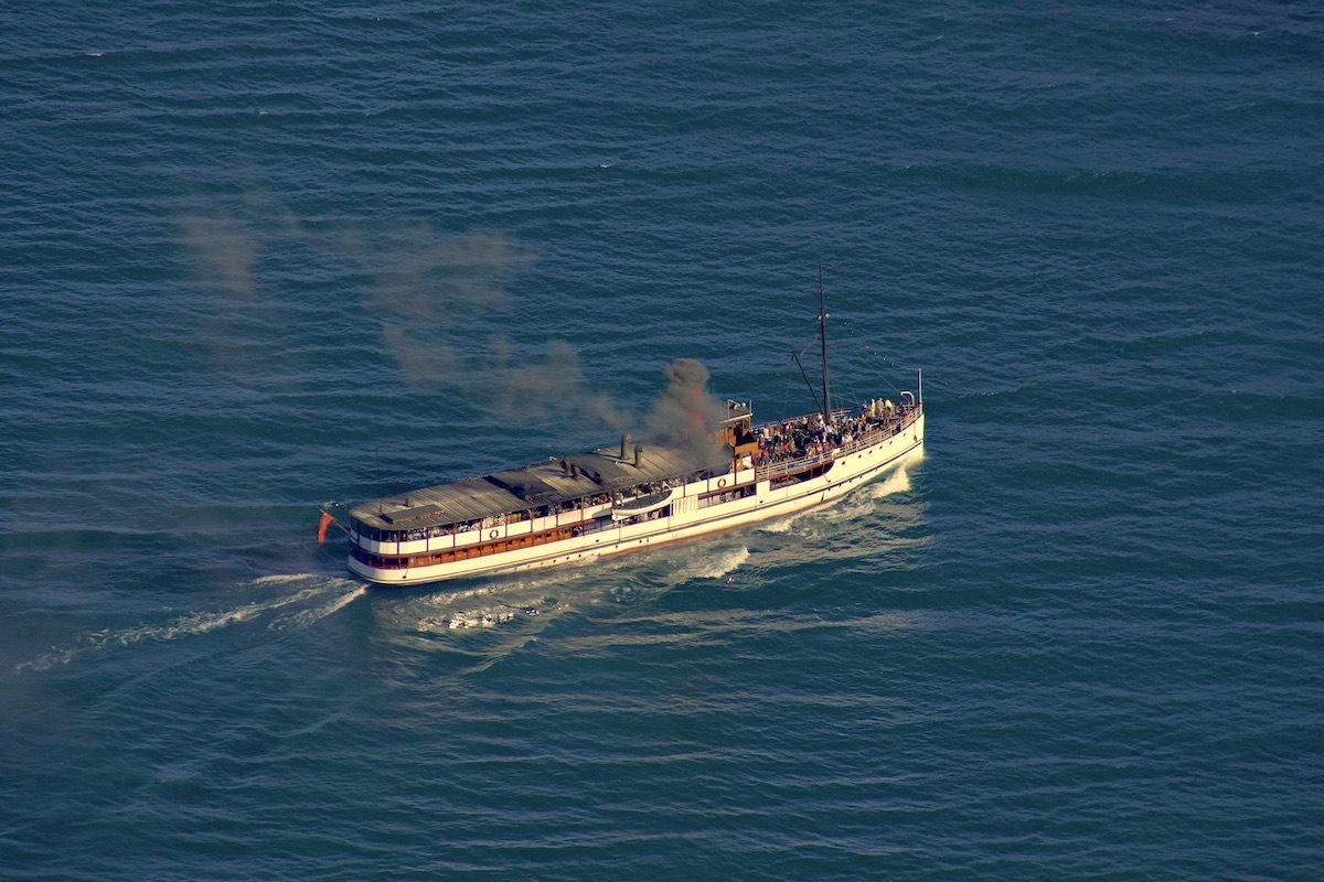
It was a very full week, with markets, museums, river walks and strenuous hikes to glaciers and over part of an historic track. We went past the Treble Cone ski area that our son had enjoyed one year, and of course visited Queenstown and rode the lake steamer that has served on Lake Wakatipu since 1912.
Wanaka
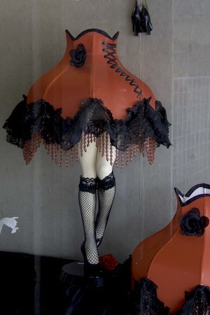
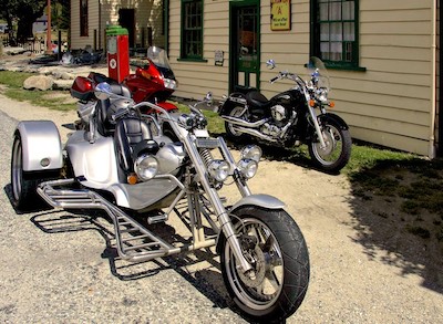
On Saturday we picked our cousins up at Queenstown Airport, under the stern gaze of the 3 Maori chiefs who guard the airport entrance, and took them back to Wanaka, over the Cardrona Pass. We lunched at the Cardrona Pub, with its attendant antique roadsters, "funny" cycles, and stuffed boar's head - then walked along the river from our house in Albert Town.
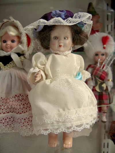
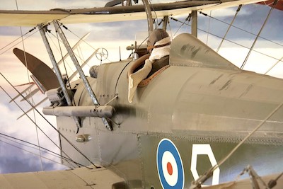
We spent a lot of time in the vicinity, exploring the river bank, walking to Wanaka town itself, attending the Sunday Market by the lake shore, and visiting two museums at the airport: the NZ Fighter Pilot's Musem and the Toys and Transport Museum.
-
Wanaka Funny motorcycles
-
Wanaka Crown Range Road
-

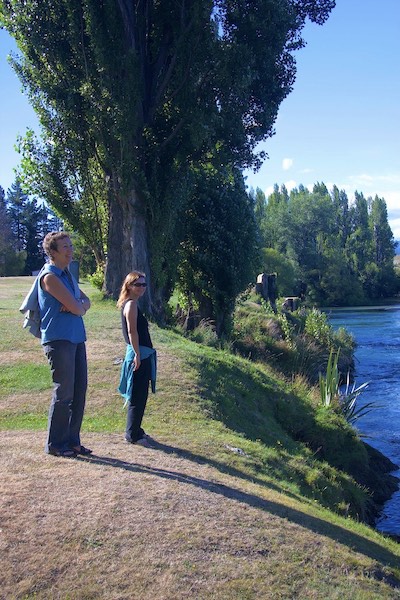
Wanaka It's a handsome river
-

Wanaka Pub decor
-

Wanaka Lakeside
-

Wanaka Have another
-
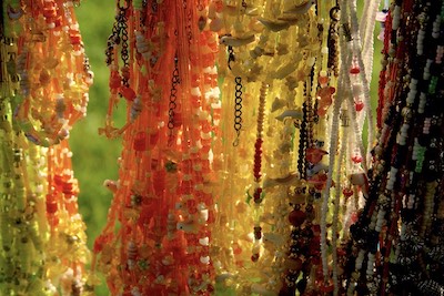
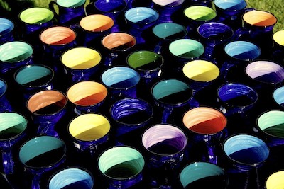
Wanaka Beads galore
-
Wanaka Waiting
-
Wanaka Chasing tails
-
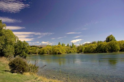
Wanaka Clutha River
-
Wanaka Clutha Nymphs
-
Wanaka Mugshot
-
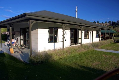
Wanaka Our rental house
-
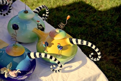
Wanaka Whimsical teapots
-
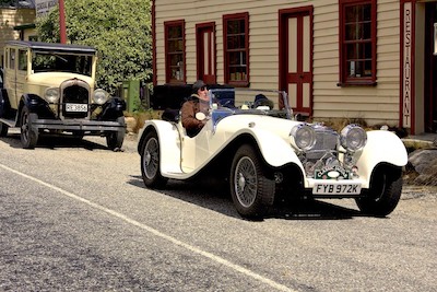
Wanaka Classic Jaguar
-
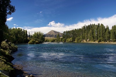
Wanaka Clutha River
-

Wanaka NZ Fighter Pilots Museum
-
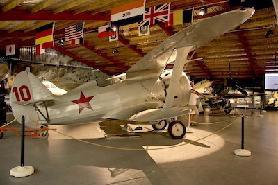
Wanaka NZ Fighter Pilots Museum
-
Wanaka I had too much too
-

Wanaka Also waiting


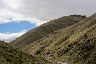
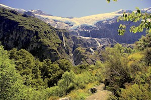
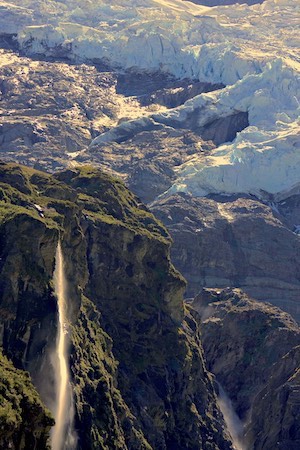
Rob Roy Glacier
Our hike to the Rob Roy Glacier was magnificent. We drove out past Glendhu Bay and Parkins Bay, and up the Matukituki Valley to the start of the hike, inside Mt. Aspiring National Park. The hike followed the Rob Roy stream up the mountain, through beech forests and with dramatic views of waterfalls, mountains and glaciers, enlivened by the crashing sounds of ice calving off the glacier and plunging down the cliff below.
We lunched in the sun on a mountain slope, looking out at the Rob Roy Glacier and the long thin waterfall of melt water. There were others there too, not of our party, but not many and we each kept to ourselves.
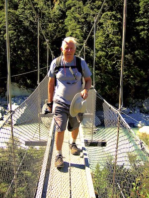
Eventually of course we had to turn back and set off home, as it was still a long hike in front of us and the day moved on. Gravity was more our friend on the way down, as we were tired by now and appreciated the easier going of walking downhill. There was more to see as the sun had moved, the shadows had changed, and we were looking the other way. Still, we were pleased to reach the bridge across the Matukituki.
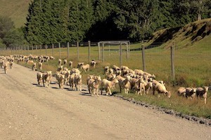
We drove home through a flock of newly shorn sheep - speculating that they might find their nights in the mountains a tad chilly now, without their coats.
-

Rob Roy Glacier Heavy camera gear
-
Rob Roy Glacier Last look
-
Rob Roy Glacier Glendhu Bay road
-
Rob Roy Glacier Getting closer
-
Rob Roy Glacier Parkins Bay
-

Rob Roy Glacier Weary
-
Rob Roy Glacier Beside the track
-
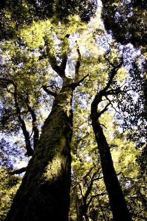
Rob Roy Glacier Beech trees
-

Rob Roy Glacier Lunchtime view
-
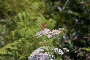
Rob Roy Glacier Butterfly
-
Rob Roy Glacier Close to the car
-
Rob Roy Glacier We saw it all that day
-
Rob Roy Glacier Rob Roy Glacier track
-
Rob Roy Glacier Glacier melt
-
Rob Roy Glacier Coatless
-

Rob Roy Glacier Icy cold
-
Rob Roy Glacier Beech trees
-
Rob Roy Glacier Matukituki bridge
-
Rob Roy Glacier Matukituki Valley
-
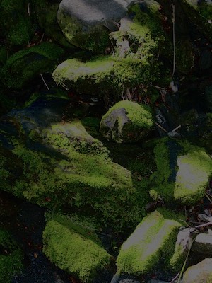
Rob Roy Glacier Mossy rocks


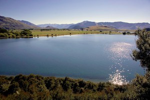
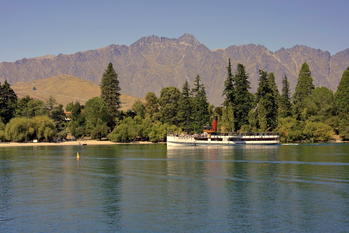
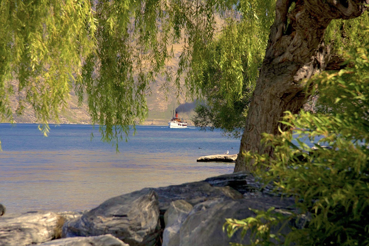
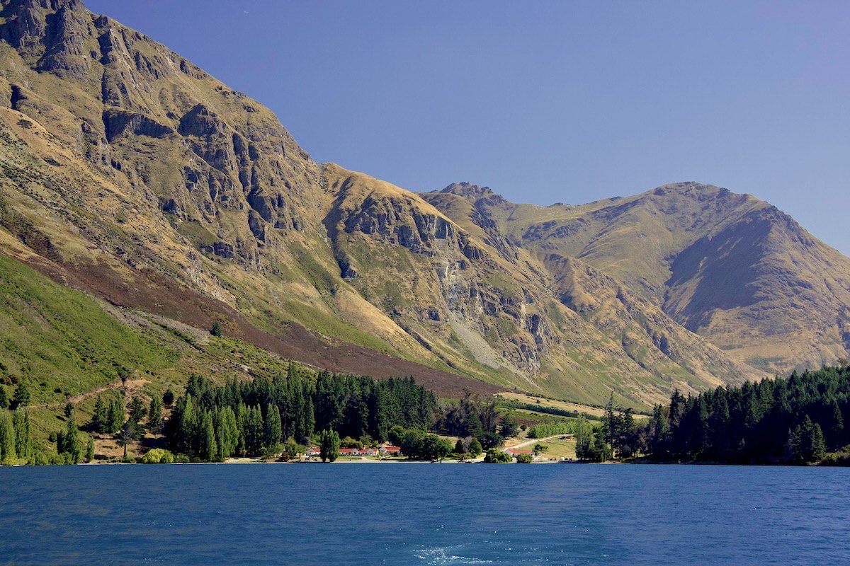
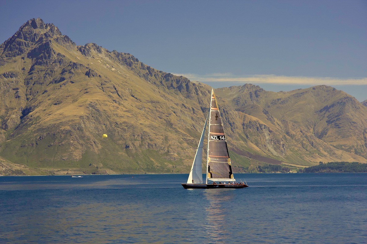
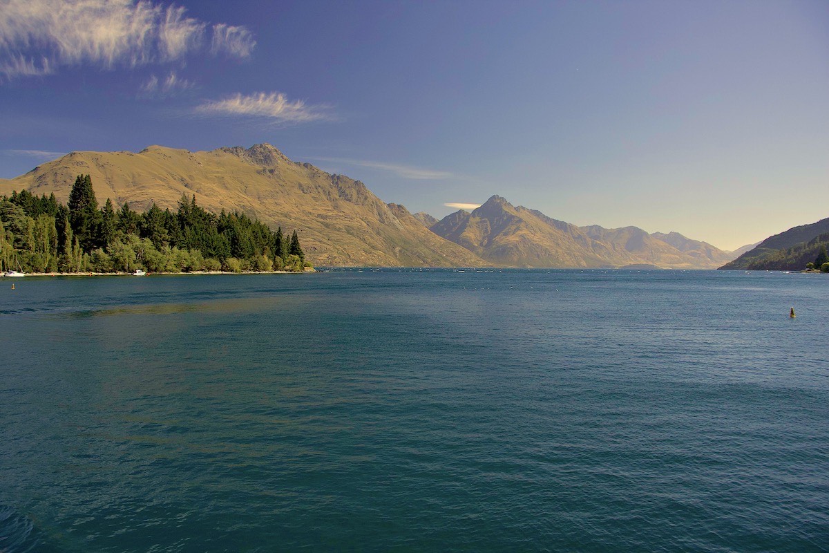
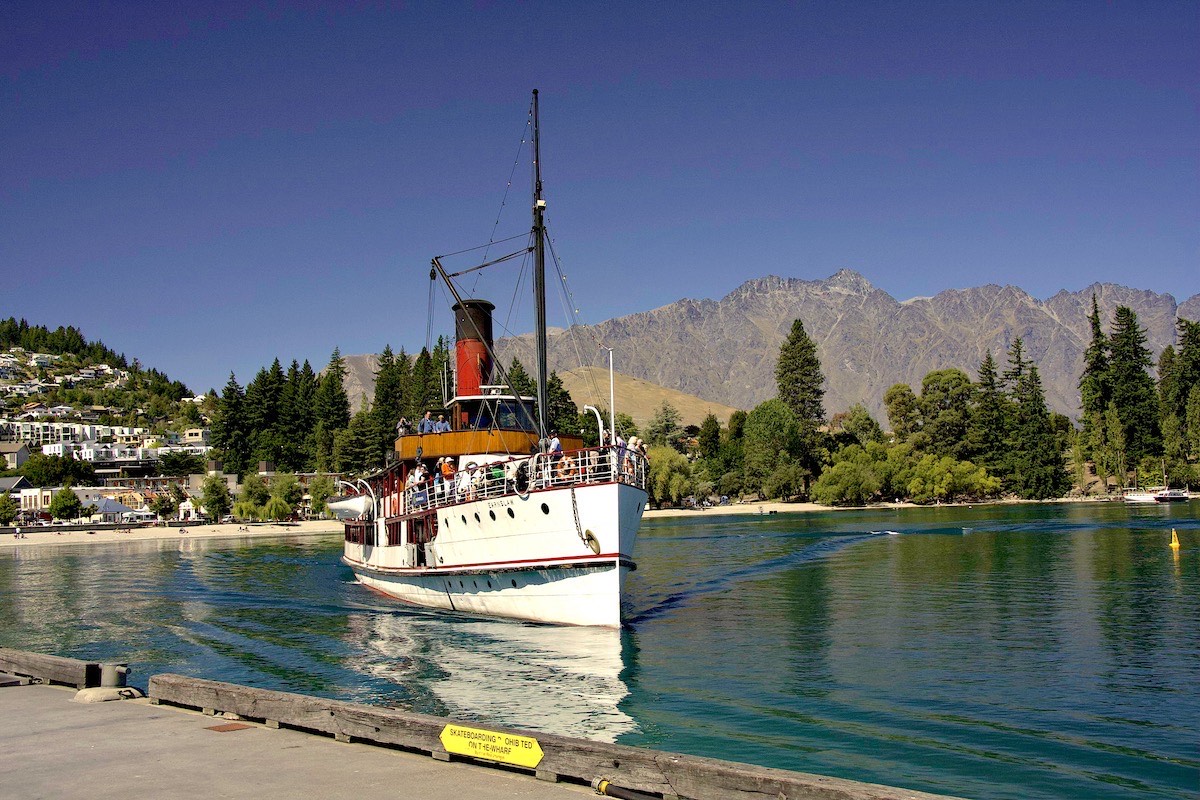
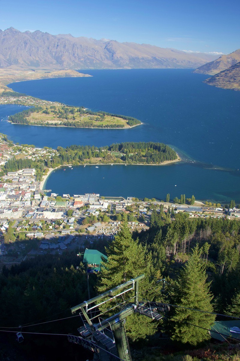
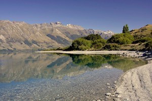
Queenstown and Lake Wakatipu
On past the serene Lake Hayes the next day, to the somewhat frenetic Queenstown. There we took an excursion on the historic Earnslaw steamship to Walter Peak Sheep Station and back. We did not stop there for a tour - having been raised on a sheep farm, being a tourist at a sheep station held little appeal.
We also went up to the Skyline Chalet, where the view of Lake Wakatipu is tremendous.
-
Wakatipu The Earnslaw
-
Wakatipu The Earnslaw
-
Wakatipu Leaving Walter Peak Station
-
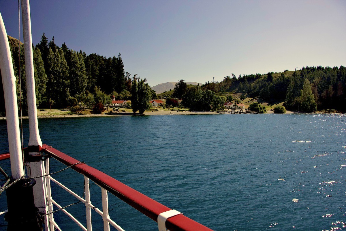
Wakatipu Walter Peak Station
-
Wakatipu Retired
-
Wakatipu Cruising
-
Wakatipu Lake Wakatipu
-
Wakatipu Docking
-
Wakatipu Queenstown
-
Wakatipu Earnslaw
-
Wakatipu Peaceful
-
Wakatipu Double Headed
-
Wakatipu Sunbathing


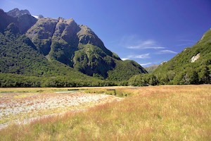
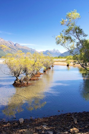
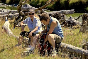
The Routeburn Track
Another wonderful day hiking on the eastern half of the Routeburn Track. The full track runs from near Glenorchy through to meet the Milford Sound Highway. We had previously hiked the west end as far as Key Summit. We didn't manage to go so far up the west end that we could claim to have walked the full Track.
-

Routeburn Tourists
-
Routeburn The Routeburn valley
-
Routeburn At Glenorchy
-

Routeburn Forest track
-
Routeburn Near Glenorchy
-
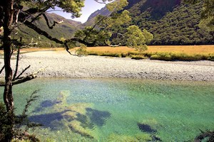
Routeburn The Route Burn
-
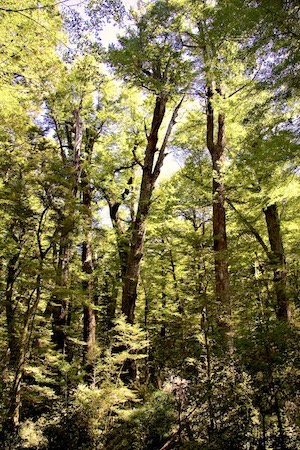
Routeburn Beeches
-
Routeburn The Route Burn
-
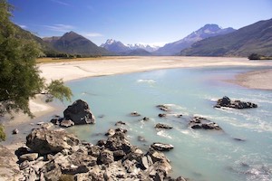
Routeburn The Dart River
-
Routeburn Lunchtime
-

Routeburn Pruned
-

Routeburn Fresh growth


